
Thank you for supporting this site ❤️
Make a donation
Make a donation
Santo Niño topographic map
Click on the map to display elevation.
Thank you for supporting this site ❤️
Make a donation
Make a donation
About this map
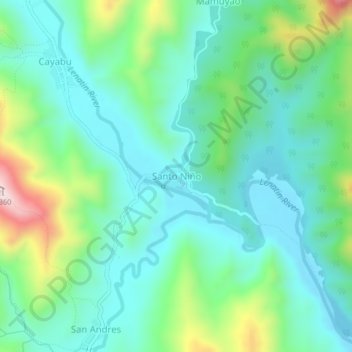
Name: Santo Niño topographic map, elevation, terrain.
Location: Santo Niño, Tanay, Rizal, Calabarzon, Philippines (14.62987 121.33684 14.66987 121.37684)
Average elevation: 331 m
Minimum elevation: 206 m
Maximum elevation: 701 m
Thank you for supporting this site ❤️
Make a donation
Make a donation
Other topographic maps
Click on a map to view its topography, its elevation and its terrain.