
Thank you for supporting this site ❤️
Make a donation
Make a donation
Lake Onega topographic map
Click on the map to display elevation.
Thank you for supporting this site ❤️
Make a donation
Make a donation
About this map
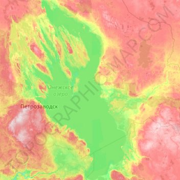
Name: Lake Onega topographic map, elevation, terrain.
Average elevation: 102 m
Minimum elevation: 18 m
Maximum elevation: 309 m
Thank you for supporting this site ❤️
Make a donation
Make a donation
Other topographic maps
Click on a map to view its topography, its elevation and its terrain.
Petrozavodsk
Russia > Republic of Karelia > Petrozavodsk Urban Okrug > Petrozavodsk
Average elevation: 90 m
Thank you for supporting this site ❤️
Make a donation
Make a donation