
Außenalster topographic map
Interactive map
Click on the map to display elevation.
About this map
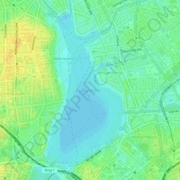
Name: Außenalster topographic map, elevation, terrain.
Average elevation: 12 m
Minimum elevation: 2 m
Maximum elevation: 27 m
Other topographic maps
Click on a map to view its topography, its elevation and its terrain.
Nationalpark Hamburgisches Wattenmeer
Nationalpark Hamburgisches Wattenmeer, Wattwanderweg Neuwerk - Scharhörn, Hamburg Neuwerk, Hamburg-Mitte, Hambourg, 27499, Allemagne
Average elevation: 0 m