
Thank you for supporting this site ❤️
Make a donation
Make a donation
Phúc Thọ topographic map
Click on the map to display elevation.
Thank you for supporting this site ❤️
Make a donation
Make a donation
About this map
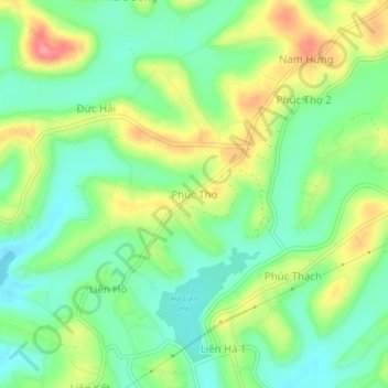
Name: Phúc Thọ topographic map, elevation, terrain.
Location: Phúc Thọ, Xã Tân Hà Lâm Hà, Lâm Đồng Province, Vietnam (11.70778 108.13923 11.74778 108.17923)
Average elevation: 947 m
Minimum elevation: 911 m
Maximum elevation: 1,005 m
Thank you for supporting this site ❤️
Make a donation
Make a donation