
Thank you for supporting this site ❤️
Make a donation
Make a donation
Turner Falls topographic map
Click on the map to display elevation.
Thank you for supporting this site ❤️
Make a donation
Make a donation
About this map
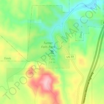
Name: Turner Falls topographic map, elevation, terrain.
Location: Turner Falls, Davis, Murray County, Oklahoma, United States (34.42553 -97.14819 34.42563 -97.14809)
Average elevation: 325 m
Minimum elevation: 251 m
Maximum elevation: 422 m
Thank you for supporting this site ❤️
Make a donation
Make a donation