
Thank you for supporting this site ❤️
Make a donation
Make a donation
Pulamanthole topographic map
Click on the map to display elevation.
Thank you for supporting this site ❤️
Make a donation
Make a donation
About this map
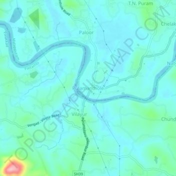
Name: Pulamanthole topographic map, elevation, terrain.
Average elevation: 33 m
Minimum elevation: 8 m
Maximum elevation: 173 m
Thank you for supporting this site ❤️
Make a donation
Make a donation
Other topographic maps
Click on a map to view its topography, its elevation and its terrain.
Kolaparamba
India > Kerala > Perinthalmanna > Kollithodi SC Colony > Pattiyiparamb SC colony
Average elevation: 62 m
Temple Pond, Bhagavathi Padam, Angadippuram
India > Kerala > Perinthalmanna > Angadipuram
Average elevation: 45 m
Thank you for supporting this site ❤️
Make a donation
Make a donation