
秦皇岛市 topographic map
Interactive map
Click on the map to display elevation.
About this map
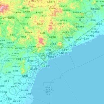
Name: 秦皇岛市 topographic map, elevation, terrain.
Location: 秦皇岛市, Hebei, China (39.36297 118.56309 40.61550 119.95285)
Average elevation: 143 m
Minimum elevation: -3 m
Maximum elevation: 1,760 m
Other topographic maps
Click on a map to view its topography, its elevation and its terrain.