
Thank you for supporting this site ❤️
Make a donation
Make a donation
Imbaya topographic map
Click on the map to display elevation.
Thank you for supporting this site ❤️
Make a donation
Make a donation
About this map
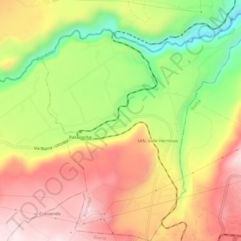
Name: Imbaya topographic map, elevation, terrain.
Location: Imbaya, Atuntaqui, Imbabura, Ecuador (0.35495 -78.17484 0.40204 -78.13345)
Average elevation: 2,068 m
Minimum elevation: 1,769 m
Maximum elevation: 2,323 m
Thank you for supporting this site ❤️
Make a donation
Make a donation
Other topographic maps
Click on a map to view its topography, its elevation and its terrain.