
Le Julien topographic map
Interactive map
Click on the map to display elevation.
About this map
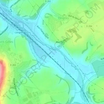
Name: Le Julien topographic map, elevation, terrain.
Average elevation: 367 m
Minimum elevation: 330 m
Maximum elevation: 463 m
Other topographic maps
Click on a map to view its topography, its elevation and its terrain.
Le Julien
França > Grande Leste > Langres
Le Julien, Langres, Haute-Marne, Grande Leste, França metropolitana, 52200, França
Average elevation: 383 m