
Buseck topographic map
Click on the map to display elevation.
About this map
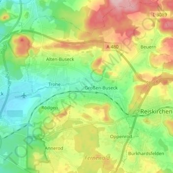
Name: Buseck topographic map, elevation, terrain.
Location: Buseck, Landkreis Gießen, Hesse, 35418, Germany (50.56842 8.73146 50.64873 8.86068)
Average elevation: 232 m
Minimum elevation: 159 m
Maximum elevation: 354 m
Other topographic maps
Click on a map to view its topography, its elevation and its terrain.