
Kronenburg topographic map
Interactive map
Click on the map to display elevation.
About this map
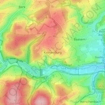
Name: Kronenburg topographic map, elevation, terrain.
Average elevation: 544 m
Minimum elevation: 459 m
Maximum elevation: 643 m
Other topographic maps
Click on a map to view its topography, its elevation and its terrain.
Kronenburger See
Duitsland > Noordrijn-Westfalen > Kreis Euskirchen > Kronenburg
Kronenburger See, Kronenburg, Dahlem, Gerolstein, Kreis Euskirchen, Noordrijn-Westfalen, 53949, Duitsland
Average elevation: 554 m