
Thank you for supporting this site ❤️
Make a donation
Make a donation
Menomonee Falls topographic map
Click on the map to display elevation.
Thank you for supporting this site ❤️
Make a donation
Make a donation
About this map
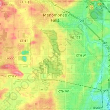
Name: Menomonee Falls topographic map, elevation, terrain.
Location: Menomonee Falls, Waukesha County, Wisconsin, United States (43.10457 -88.18567 43.19261 -88.06336)
Average elevation: 254 m
Minimum elevation: 215 m
Maximum elevation: 302 m
Thank you for supporting this site ❤️
Make a donation
Make a donation
Other topographic maps
Click on a map to view its topography, its elevation and its terrain.
Menomonee Falls
United States > Wisconsin > Waukesha County > Menomonee Falls
Average elevation: 260 m
Thank you for supporting this site ❤️
Make a donation
Make a donation