
Thank you for supporting this site ❤️
Make a donation
Make a donation
Szár topographic map
Click on the map to display elevation.
Thank you for supporting this site ❤️
Make a donation
Make a donation
About this map
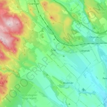
Name: Szár topographic map, elevation, terrain.
Location: Szár, Bicskei járás, Fejér, Transdanubia, 2066, Hungary (47.45336 18.42967 47.49810 18.56520)
Average elevation: 230 m
Minimum elevation: 128 m
Maximum elevation: 491 m
Thank you for supporting this site ❤️
Make a donation
Make a donation
Other topographic maps
Click on a map to view its topography, its elevation and its terrain.