
Isolo topographic map
Interactive map
Click on the map to display elevation.
About this map
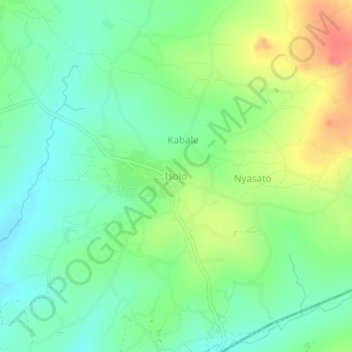
Name: Isolo topographic map, elevation, terrain.
Location: Isolo, Magu, Mwanza Region, Lake Zone, Tanzania (-2.82866 33.67072 -2.78866 33.71072)
Average elevation: 1,235 m
Minimum elevation: 1,212 m
Maximum elevation: 1,273 m
Other topographic maps
Click on a map to view its topography, its elevation and its terrain.