
Cañete topographic map
Interactive map
Click on the map to display elevation.
Cañete
Cañete ist eine Stadt in Chile in der Región del Bío-Bío. Sie liegt ca. 154 km von Arauco entfernt. Cañete hat rund 16.000 Einwohner und liegt 71 m über Meereshöhe. Die touristischen Hauptattraktionen sind das Archäologische Museum und die Besichtigungsstätten der Mapuche-Kultur.
About this map
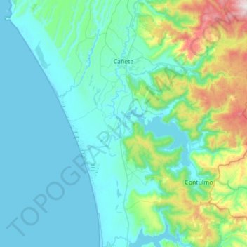
Name: Cañete topographic map, elevation, terrain.
Average elevation: 191 m
Minimum elevation: 0 m
Maximum elevation: 1,346 m
Other topographic maps
Click on a map to view its topography, its elevation and its terrain.