
Dublin topographic map
Click on the map to display elevation.
About this map
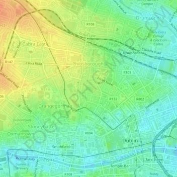
Name: Dublin topographic map, elevation, terrain.
Location: Dublin, County Dublin, Leinster, Ireland (53.35717 -6.27140 53.35735 -6.27101)
Average elevation: 19 m
Minimum elevation: 2 m
Maximum elevation: 42 m
Other topographic maps
Click on a map to view its topography, its elevation and its terrain.