
Thank you for supporting this site ❤️
Make a donation
Make a donation
Umbare (D) topographic map
Click on the map to display elevation.
Thank you for supporting this site ❤️
Make a donation
Make a donation
About this map
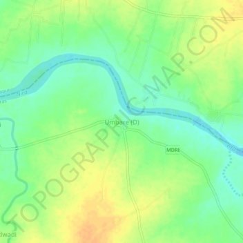
Name: Umbare (D) topographic map, elevation, terrain.
Location: Umbare (D), Malshiras, Solapur, Maharashtra, India (17.92183 74.85282 17.96183 74.89282)
Average elevation: 493 m
Minimum elevation: 478 m
Maximum elevation: 508 m
Thank you for supporting this site ❤️
Make a donation
Make a donation
Other topographic maps
Click on a map to view its topography, its elevation and its terrain.