
Make a donation
Oton topographic map
Click on the map to display elevation.
Make a donation
Oton
Oton is located 9 kilometers northwest from the city of Knin. It is scattered across a wide area between the canyon of Zrmanja river on the west and Radljevac river on the east. To the south, the border of the village is Debelo Brdo. The village is divided into Oton Polje and Oton Brdo according to its geographical characteristics and the altitude of its hamlets. The villages of Bender and Kobilice also belong to the Oton region. Oton Polje consists of the following hamlets: Dobrijevići, Karanovići, Kneževići, Mišljeni and Vujnovići, and Oton Brdo consists of the following hamlets: Atlije, Karne, Kneževići, Kovačevići, Opačići, Sudari, Rastovići, Višekrune and Žunići. Bender consists of hamlets: Dobrijevići, Čupkovići, Pašići and Runjajići.
Make a donation
About this map
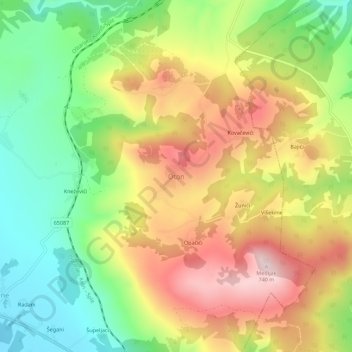
Name: Oton topographic map, elevation, terrain.
Location: Oton, Općina Ervenik, Šibenik-Knin County, Croatia (44.08127 16.10654 44.12127 16.14654)
Average elevation: 521 m
Minimum elevation: 334 m
Maximum elevation: 734 m
Make a donation