Glen Huon topographic map
Interactive map
Click on the map to display elevation.
About this map
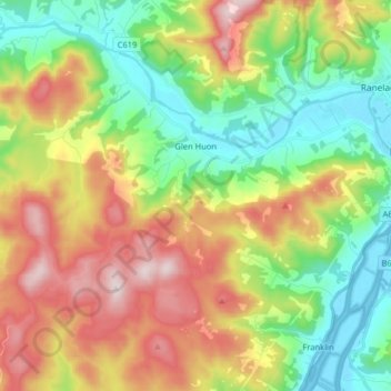
Name: Glen Huon topographic map, elevation, terrain.
Location: Glen Huon, Huon Valley, Tasmania, 7140, Australia (-43.08530 146.85252 -42.99980 147.01332)
Average elevation: 247 m
Minimum elevation: -3 m
Maximum elevation: 621 m
Other topographic maps
Click on a map to view its topography, its elevation and its terrain.
Launceston
Launceston, City of Launceston, Tasmania, Australia
Average elevation: 194 m
Queenstown
Queenstown, West Coast, Tasmania, 7467, Australia
Average elevation: 330 m
Campbell Town
Australia > Tasmania > Campbell Town
Campbell Town, Northern Midlands, Tasmania, 7210, Australia
Average elevation: 345 m
Clarence Point
Australia > Tasmania > Clarence Point
Clarence Point, West Tamar, Tasmania, Australia
Average elevation: 13 m
Legana
Australia > Tasmania > Launceston > Legana
Legana, Launceston, West Tamar, Tasmania, Australia
Average elevation: 82 m
Mount Nelson
Mount Nelson, Hobart, City of Hobart, Tasmania, Australia
Average elevation: 198 m