
forêt communale de Siran topographic map
Interactive map
Click on the map to display elevation.
About this map
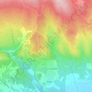
Name: forêt communale de Siran topographic map, elevation, terrain.
Average elevation: 246 m
Minimum elevation: 103 m
Maximum elevation: 414 m
Other topographic maps
Click on a map to view its topography, its elevation and its terrain.
forêt communale de Siran
forêt communale de Siran, D 56, Lauriole, Siran, Béziers, Hérault, Occitanie, France métropolitaine, 34210, France
Average elevation: 237 m