
Kapellen topographic map
Interactive map
Click on the map to display elevation.
About this map
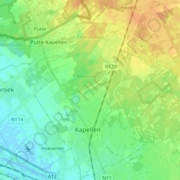
Name: Kapellen topographic map, elevation, terrain.
Location: Kapellen, Antwerpen, Vlaanderen, 2950, België (51.30044 4.39172 51.36442 4.51900)
Average elevation: 11 m
Minimum elevation: -3 m
Maximum elevation: 28 m
Other topographic maps
Click on a map to view its topography, its elevation and its terrain.