
Thank you for supporting this site ❤️
Make a donation
Make a donation
Gârda de Sus topographic map
Click on the map to display elevation.
Thank you for supporting this site ❤️
Make a donation
Make a donation
About this map
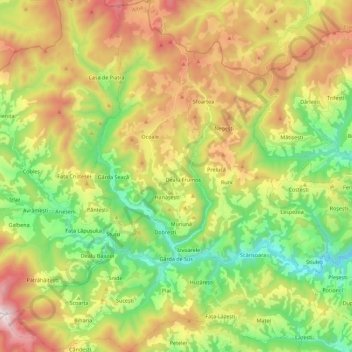
Name: Gârda de Sus topographic map, elevation, terrain.
Location: Gârda de Sus, Alba, Romania (46.41460 22.71992 46.56897 22.86153)
Average elevation: 1,108 m
Minimum elevation: 649 m
Maximum elevation: 1,765 m
Thank you for supporting this site ❤️
Make a donation
Make a donation
Other topographic maps
Click on a map to view its topography, its elevation and its terrain.