
Thank you for supporting this site ❤️
Make a donation
Make a donation
Barney topographic map
Click on the map to display elevation.
Thank you for supporting this site ❤️
Make a donation
Make a donation
About this map
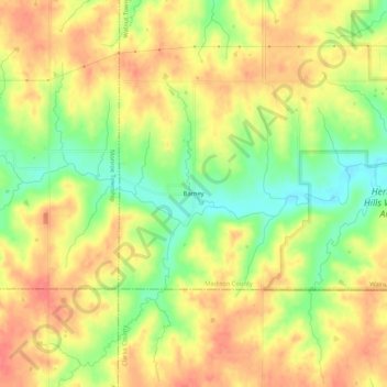
Name: Barney topographic map, elevation, terrain.
Location: Barney, Walnut Township, Madison County, Iowa, United States (41.14666 -94.02384 41.18666 -93.98384)
Average elevation: 346 m
Minimum elevation: 311 m
Maximum elevation: 371 m
Thank you for supporting this site ❤️
Make a donation
Make a donation
Other topographic maps
Click on a map to view its topography, its elevation and its terrain.