
Thank you for supporting this site ❤️
Make a donation
Make a donation
Bwindi topographic map
Click on the map to display elevation.
Thank you for supporting this site ❤️
Make a donation
Make a donation
About this map
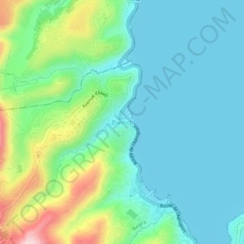
Name: Bwindi topographic map, elevation, terrain.
Location: Bwindi, Bukavu, South Kivu, Democratic Republic of the Congo (-2.49028 28.81694 -2.45028 28.85694)
Average elevation: 1,531 m
Minimum elevation: 1,456 m
Maximum elevation: 1,756 m
Thank you for supporting this site ❤️
Make a donation
Make a donation