
Picket Hill topographic map
Interactive map
Click on the map to display elevation.
About this map
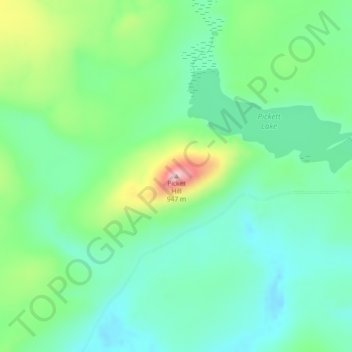
Name: Picket Hill topographic map, elevation, terrain.
Average elevation: 924 m
Minimum elevation: 868 m
Maximum elevation: 1,059 m
Other topographic maps
Click on a map to view its topography, its elevation and its terrain.
Johns Island
Canada > British Columbia > Regional District of Bulkley-Nechako > Area E (Ootsa Lake/François Lake)
Johns Island, Area E (Ootsa Lake/François Lake), Regional District of Bulkley-Nechako, British Columbia, Canada
Average elevation: 965 m
François Lake
Canada > British Columbia > Regional District of Bulkley-Nechako > Area E (Ootsa Lake/François Lake)
François Lake, Area E (Ootsa Lake/François Lake), Regional District of Bulkley-Nechako, British Columbia, Canada
Average elevation: 984 m