
Kandahar topographic map
Interactive map
Click on the map to display elevation.
About this map
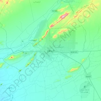
Name: Kandahar topographic map, elevation, terrain.
Location: Kandahar, Kandahar Province, 3801, Afghanistan (31.46057 65.55576 31.78057 65.87576)
Average elevation: 1,048 m
Minimum elevation: 940 m
Maximum elevation: 1,776 m