
Thank you for supporting this site ❤️
Make a donation
Make a donation
Lachtal topographic map
Click on the map to display elevation.
Thank you for supporting this site ❤️
Make a donation
Make a donation
About this map
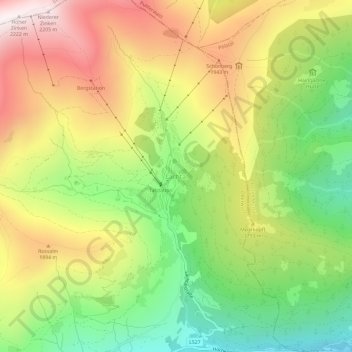
Name: Lachtal topographic map, elevation, terrain.
Location: Lachtal, Oberwölz, Bezirk Murau, Styria, 8831, Austria (47.23249 14.34824 47.27249 14.38824)
Average elevation: 1,703 m
Minimum elevation: 1,251 m
Maximum elevation: 2,213 m
Thank you for supporting this site ❤️
Make a donation
Make a donation
Other topographic maps
Click on a map to view its topography, its elevation and its terrain.
Sankt Peter am Kammersberg
Austria > Styria > Bezirk Murau > Sankt Peter am Kammersberg
Average elevation: 1,330 m
Thank you for supporting this site ❤️
Make a donation
Make a donation