
Pont-la-Ville topographic map
Interactive map
Click on the map to display elevation.
About this map
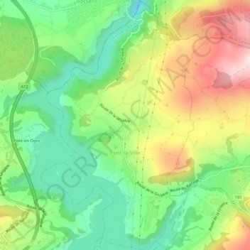
Name: Pont-la-Ville topographic map, elevation, terrain.
Location: Pont-la-Ville, District de la Gruyère, Fribourg, 1649, Suisse (46.68530 7.09369 46.72051 7.12842)
Average elevation: 759 m
Minimum elevation: 607 m
Maximum elevation: 983 m