
Henderson topographic map
Click on the map to display elevation.
Henderson
Henderson is a city in Clark County, Nevada, United States, about 16 miles (26 km) southeast of downtown Las Vegas. It is the 2nd most populous city in Nevada, after Las Vegas, with an estimated population of 320,189 in 2019. The city is part of the Las Vegas Valley. Henderson occupies the southeastern end of the valley, at an elevation of 1,864 feet (568 m).
About this map
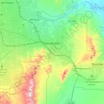
Name: Henderson topographic map, elevation, terrain.
Location: Henderson, Clark County, Nevada, United States (35.89182 -115.21936 36.12498 -114.90220)
Average elevation: 691 m
Minimum elevation: 365 m
Maximum elevation: 1,538 m