
Troyes topographic map
Interactive map
Click on the map to display elevation.
About this map
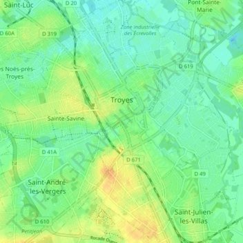
Name: Troyes topographic map, elevation, terrain.
Location: Troyes, Aube, Grand Est, France métropolitaine, 10000, France (48.26632 4.04117 48.31859 4.11114)
Average elevation: 112 m
Minimum elevation: 100 m
Maximum elevation: 132 m
La superficie de la commune de Troyes est de 1 320 ha quand la superficie moyenne communale en France métropolitaine s'établit à 1 505,8 ha ; son altitude varie de 100 m, au niveau de la Seine à la limite entre Troyes et Barberey-Saint-Sulpice, à 126 m au sud-ouest, à la limite du territoire communal de Saint-André-les-Vergers.
Other topographic maps
Click on a map to view its topography, its elevation and its terrain.
Saint-Aubin
Saint-Aubin, Nogent-sur-Seine, Aube, Grand Est, France métropolitaine, 10400, France
Average elevation: 102 m
Villechétif
Villechétif, Troyes, Aube, Grand Est, France métropolitaine, 10410, France
Average elevation: 123 m