
Thank you for supporting this site ❤️
Make a donation
Make a donation
Stakčín topographic map
Click on the map to display elevation.
Thank you for supporting this site ❤️
Make a donation
Make a donation
Stakčín
The municipality lies in the Cirocha river valley, at an altitude of 257 metres and with a total area of 167.742 km2. According to the 2013 census it had a population of 2452 inhabitants. It lies between the Vihorlat and Bukovské vrchy mountains. The municipality is the seat of the Poloniny National Park governing body.
Thank you for supporting this site ❤️
Make a donation
Make a donation
About this map
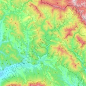
Name: Stakčín topographic map, elevation, terrain.
Average elevation: 471 m
Minimum elevation: 181 m
Maximum elevation: 1,147 m
Thank you for supporting this site ❤️
Make a donation
Make a donation
Other topographic maps
Click on a map to view its topography, its elevation and its terrain.