
Thank you for supporting this site ❤️
Make a donation
Make a donation
Deer Isle topographic map
Click on the map to display elevation.
Thank you for supporting this site ❤️
Make a donation
Make a donation
About this map
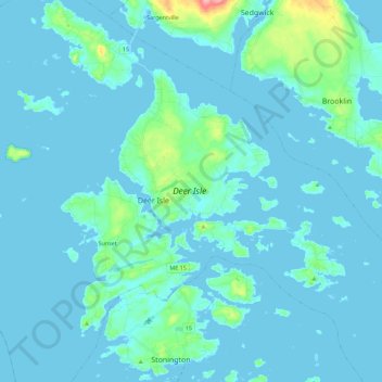
Name: Deer Isle topographic map, elevation, terrain.
Location: Deer Isle, Hancock County, Maine, USA (44.14700 -68.74397 44.30879 -68.56378)
Average elevation: 9 m
Minimum elevation: -2 m
Maximum elevation: 105 m
Thank you for supporting this site ❤️
Make a donation
Make a donation
Other topographic maps
Click on a map to view its topography, its elevation and its terrain.