
Thank you for supporting this site ❤️
Make a donation
Make a donation
Wales topographic map
Click on the map to display elevation.
Thank you for supporting this site ❤️
Make a donation
Make a donation
About this map
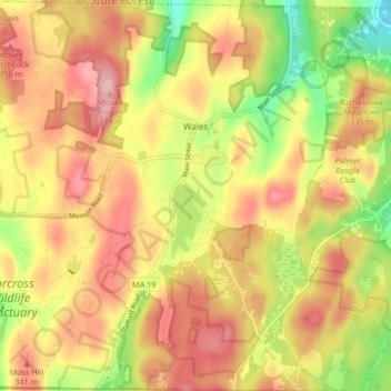
Name: Wales topographic map, elevation, terrain.
Location: Wales, Hampden County, Massachusetts, 01081, United States (42.03102 -72.27066 42.09252 -72.19189)
Average elevation: 299 m
Minimum elevation: 198 m
Maximum elevation: 379 m
Thank you for supporting this site ❤️
Make a donation
Make a donation
Other topographic maps
Click on a map to view its topography, its elevation and its terrain.