
Ohey topographic map
Interactive map
Click on the map to display elevation.
About this map
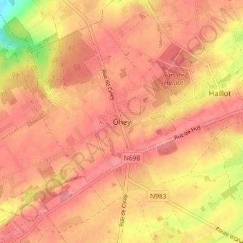
Name: Ohey topographic map, elevation, terrain.
Location: Ohey, Namen, Wallonië, 5350, België (50.41591 5.10384 50.45591 5.14384)
Average elevation: 259 m
Minimum elevation: 191 m
Maximum elevation: 285 m
Ohey is een plaats en gemeente in de provincie Namen in België. De gemeente telt iets meer dan 5.000 inwoners en ligt op een hoogte van 259 meter.