
Faaa topographic map
Interactive map
Click on the map to display elevation.
About this map
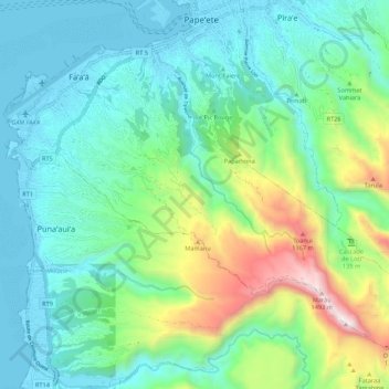
Name: Faaa topographic map, elevation, terrain.
Location: Faaa, Îles du Vent, Polynésie française, 98704, France (-17.62447 -149.62090 -17.54416 -149.49914)
Average elevation: 192 m
Minimum elevation: -2 m
Maximum elevation: 1,314 m