
Sierra Jabalcuz topographic map
Interactive map
Click on the map to display elevation.
About this map
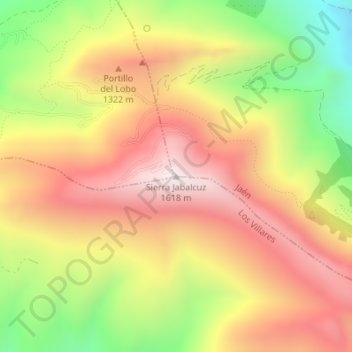
Name: Sierra Jabalcuz topographic map, elevation, terrain.
Location: Sierra Jabalcuz, Jaén, Andalucía, España (37.73733 -3.84311 37.73743 -3.84301)
Average elevation: 1,223 m
Minimum elevation: 758 m
Maximum elevation: 1,599 m
Other topographic maps
Click on a map to view its topography, its elevation and its terrain.