
Candelaria topographic map
Interactive map
Click on the map to display elevation.
About this map
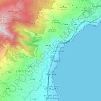
Name: Candelaria topographic map, elevation, terrain.
Location: Candelaria, Santa Cruz de Tenerife, Canary Islands, Spain (28.33929 -16.44760 28.41466 -16.33723)
Average elevation: 429 m
Minimum elevation: 0 m
Maximum elevation: 1,729 m