
Oirlo topographic map
Interactive map
Click on the map to display elevation.
About this map
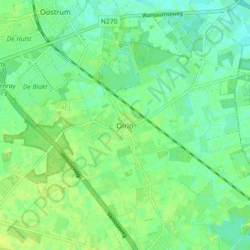
Name: Oirlo topographic map, elevation, terrain.
Location: Oirlo, Limburg, Nederland, 5808, Nederland (51.49099 6.01641 51.53099 6.05641)
Average elevation: 24 m
Minimum elevation: 17 m
Maximum elevation: 30 m
Other topographic maps
Click on a map to view its topography, its elevation and its terrain.