
Make a donation
Pontresina topographic map
Click on the map to display elevation.
Make a donation
Pontresina
Before 2017, the municipality was located in the Oberengadin sub-district of the Maloja district, after 2017 it was part of the Maloja Region. It sits in Val Bernina, which is the highest altitude valley that branches off the Upper Engadin Valley. The municipality includes the highest mountain of the canton, Piz Bernina. Other high summits are Piz Zupò and Piz Palü. Pontresina is a noted tourist destination in its own right, but is often overshadowed by its more famous neighbor St. Moritz.
Make a donation
About this map
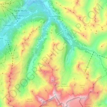
Name: Pontresina topographic map, elevation, terrain.
Location: Pontresina, Maloja, Grisons, 7504, Switzerland (46.36607 9.86964 46.51226 10.05434)
Average elevation: 2,580 m
Minimum elevation: 1,715 m
Maximum elevation: 4,010 m
Make a donation