
Jhagadia topographic map
Interactive map
Click on the map to display elevation.
About this map
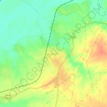
Name: Jhagadia topographic map, elevation, terrain.
Location: Jhagadia, Bharūch, Bharuch District, Gujarat, 393110, Inde (21.69572 73.12970 21.73572 73.16970)
Average elevation: 26 m
Minimum elevation: 3 m
Maximum elevation: 50 m