
Chemnitz topographic map
Interactive map
Click on the map to display elevation.
About this map
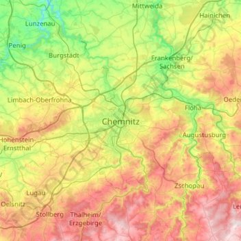
Name: Chemnitz topographic map, elevation, terrain.
Location: Chemnitz, Saxe, 09111, Allemagne (50.67226 12.76530 50.99226 13.08530)
Average elevation: 379 m
Minimum elevation: 173 m
Maximum elevation: 682 m
Other topographic maps
Click on a map to view its topography, its elevation and its terrain.