
Thank you for supporting this site ❤️
Make a donation
Make a donation
Tosashimizu topographic map
Click on the map to display elevation.
Thank you for supporting this site ❤️
Make a donation
Make a donation
About this map
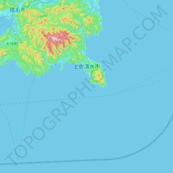
Name: Tosashimizu topographic map, elevation, terrain.
Location: Tosashimizu, Kochi Prefecture, 787-0392, Japan (32.51000 132.72709 32.93723 133.29905)
Average elevation: 40 m
Minimum elevation: 0 m
Maximum elevation: 850 m
Thank you for supporting this site ❤️
Make a donation
Make a donation
Other topographic maps
Click on a map to view its topography, its elevation and its terrain.