
Thank you for supporting this site ❤️
Make a donation
Make a donation
Le Rœulx topographic map
Click on the map to display elevation.
Thank you for supporting this site ❤️
Make a donation
Make a donation
About this map
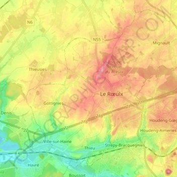
Name: Le Rœulx topographic map, elevation, terrain.
Location: Le Rœulx, Soignies, Hainaut, Wallonia, 7070, Belgium (50.46286 4.03903 50.54680 4.18641)
Average elevation: 100 m
Minimum elevation: 34 m
Maximum elevation: 168 m
Thank you for supporting this site ❤️
Make a donation
Make a donation