
Klöntal topographic map
Interactive map
Click on the map to display elevation.
About this map
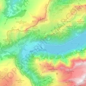
Name: Klöntal topographic map, elevation, terrain.
Location: Klöntal, Richisauerstrasse, Plätz, Glaris, Suisse (47.01921 8.89794 47.03685 9.00602)
Average elevation: 1,612 m
Minimum elevation: 826 m
Maximum elevation: 2,900 m
Other topographic maps
Click on a map to view its topography, its elevation and its terrain.