
San Miguel Allende topographic map
Interactive map
Click on the map to display elevation.
About this map
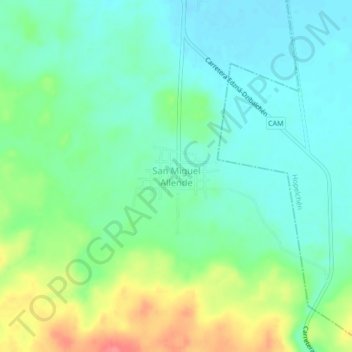
Name: San Miguel Allende topographic map, elevation, terrain.
Location: San Miguel Allende, Municipio de Campeche, Campeche, México (19.44150 -90.01537 19.48150 -89.97537)
Average elevation: 109 m
Minimum elevation: 87 m
Maximum elevation: 158 m
Other topographic maps
Click on a map to view its topography, its elevation and its terrain.
Los Laureles
México > Campeche > Municipio de Campeche > Los Laureles
Los Laureles, Municipio de Campeche, Campeche, México
Average elevation: 99 m