
Rogerville topographic map
Click on the map to display elevation.
About this map
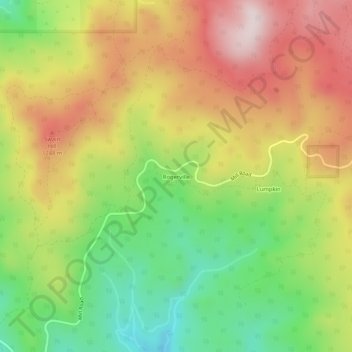
Name: Rogerville topographic map, elevation, terrain.
Location: Rogerville, Butte County, California, 95940, United States (39.59128 -121.24246 39.63128 -121.20246)
Average elevation: 1,104 m
Minimum elevation: 872 m
Maximum elevation: 1,345 m
Other topographic maps
Click on a map to view its topography, its elevation and its terrain.