
Thank you for supporting this site ❤️
Make a donation
Make a donation
Imgenbroich topographic map
Click on the map to display elevation.
Thank you for supporting this site ❤️
Make a donation
Make a donation
Imgenbroich
Imgenbroich ligt in de Eifel, en wel in het heggenlandschap van Monschau, op een hoogte van 545 meter.
Thank you for supporting this site ❤️
Make a donation
Make a donation
About this map
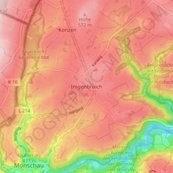
Name: Imgenbroich topographic map, elevation, terrain.
Average elevation: 514 m
Minimum elevation: 365 m
Maximum elevation: 588 m
Thank you for supporting this site ❤️
Make a donation
Make a donation