
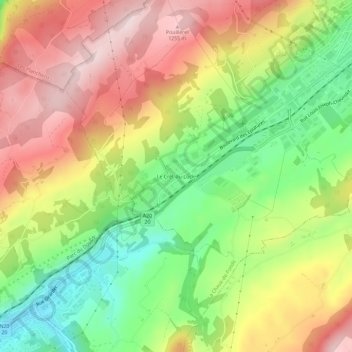
Le Crêt-du-Locle topographic map
Interactive map
Click on the map to display elevation.
About this map
Name: Le Crêt-du-Locle topographic map, elevation, terrain.
Location: Le Crêt-du-Locle, La Chaux-de-Fonds, Neuchâtel, 2322, Suisse (47.05796 6.76251 47.09796 6.80251)
Average elevation: 1,094 m
Minimum elevation: 922 m
Maximum elevation: 1,269 m