
Waldenburg topographic map
Interactive map
Click on the map to display elevation.
About this map
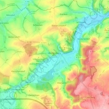
Name: Waldenburg topographic map, elevation, terrain.
Location: Waldenburg, Zwickau, Saksen, 08396, Duitsland (50.83737 12.56706 50.90932 12.65264)
Average elevation: 273 m
Minimum elevation: 214 m
Maximum elevation: 345 m