
Abstberg topographic map
Interactive map
Click on the map to display elevation.
About this map
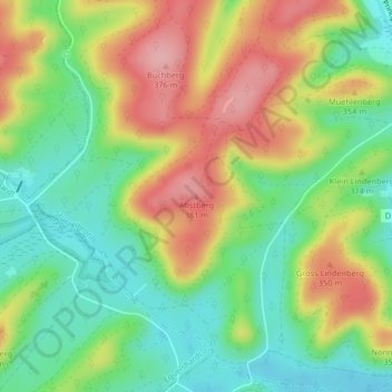
Name: Abstberg topographic map, elevation, terrain.
Average elevation: 298 m
Minimum elevation: 236 m
Maximum elevation: 378 m
Other topographic maps
Click on a map to view its topography, its elevation and its terrain.
Roter Bruch
Frankreich > Großer Osten > Stürzelbronn
Roter Bruch, Stürzelbronn, Saargemünd, Mosel, Großer Osten, Metropolitanes Frankreich, 57230, Frankreich
Average elevation: 272 m